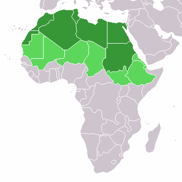
Ofbeeldienge:LocationNorthernAfrica.png
LocationNorthernAfrica.png (359 × 359 pixels, bestandsgrootte: 8 kB, MIME-type: image/png)
Bestandsgeschiedenisse
Klik op een datum/tijd om het bestand te zien zoals het destijds was.
| Datum/tijd | Miniatuur | Afmetingen | Gebruiker | Opmerking | |
|---|---|---|---|---|---|
| huidige versie | 11 nov 2022 13:16 |  | 359 × 359 (8 kB) | ColorfulSmoke | . |
| 11 nov 2022 11:54 |  | 360 × 359 (8 kB) | ColorfulSmoke | ||
| 17 mrt 2018 16:57 |  | 360 × 392 (10 kB) | Maphobbyist | Montenegro border | |
| 10 feb 2014 18:19 |  | 360 × 392 (8 kB) | Knyaz-1988 | New version | |
| 12 jan 2013 05:05 |  | 360 × 392 (13 kB) | Kuohatti | Reverted to version as of 21:04, 9 July 2011. According to http://unstats.un.org/unsd/methods/m49/m49regin.htm#africa UN doesn't count South Sudan in North Africa. | |
| 20 jul 2011 12:47 |  | 360 × 392 (8 kB) | Kahusi | See http://unstats.un.org/unsd/methods/m49/m49regin.htm | |
| 9 jul 2011 21:04 |  | 360 × 392 (13 kB) | Maphobbyist | South Sudan has become independent on July 9, 2011. Sudan and South Sudan are shown with the new international border between them. | |
| 27 mei 2009 18:55 |  | 360 × 392 (14 kB) | Elmondo21st | Reverted to version as of 08:13, 11 December 2007 | |
| 5 apr 2009 18:13 |  | 360 × 392 (14 kB) | Elmondo21st | The map of the northern Africa is about 5 main countries; Morocco, Algeria, Tunisia, Libya and Egypt. The greater northern Africa includes the Sahara countries among them Sudan. | |
| 11 dec 2007 08:13 |  | 360 × 392 (14 kB) | Hoshie | added Cabinda (Angola) |
Bloadn met dizze ofbeeldienge
Geen enkele pagina gebruikt dit bestand.
Globaal bestandsgebruik
De volgende andere wiki's gebruiken dit bestand:
- Gebruikt op ace.wikipedia.org
- Gebruikt op af.wikipedia.org
- Gebruikt op als.wikipedia.org
- Gebruikt op am.wikipedia.org
- Gebruikt op ar.wikipedia.org
- ليبيا
- جيبوتي
- موريتانيا
- تونس
- السودان
- الصحراء الغربية
- أنغولا
- أوغندا
- إسبانيا
- تشاد
- النيجر
- مالي
- السنغال
- غامبيا
- غينيا بيساو
- غينيا
- سيراليون
- ليبيريا
- غانا
- توغو
- بنين
- بوركينا فاسو
- الصومال
- كينيا
- تنزانيا
- الغابون
- زامبيا
- موزمبيق
- زيمبابوي
- البرتغال
- الكاميرون
- جمهورية الكونغو الديمقراطية
- بوتسوانا
- جنوب إفريقيا
- جمهورية إفريقيا الوسطى
- جمهورية الكونغو
- سيشل
- ناميبيا
- مدغشقر
- ليسوتو
- موريشيوس
Globaal gebruik van dit bestand bekijken.


