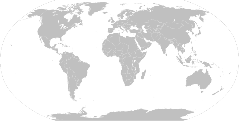
Ofbeeldienge:BlankMap-World.svg
Uiterlijk

Afmetingen van deze voorvertoning van het type PNG van dit SVG-bestand: 800 × 406 pixels Andere resoluties: 320 × 162 pixels | 640 × 325 pixels | 1.024 × 520 pixels | 1.280 × 650 pixels | 2.560 × 1.300 pixels | 2.754 × 1.398 pixels.
Ofbeeldienge in een ôgere resolutie (SVG-bestand, nominaal 2.754 × 1.398 pixels, bestandsgrootte: 1,05 MB)
Bestandsgeschiedenisse
Klik op een datum/tijd om het bestand te zien zoals het destijds was.
| Datum/tijd | Miniatuur | Afmetingen | Gebruiker | Opmerking | |
|---|---|---|---|---|---|
| huidige versie | 14 ogu 2021 09:25 |  | 2.754 × 1.398 (1,05 MB) | Seryo93 | Reverted to version as of 23:50, 11 August 2021 (UTC) messed-up again |
| 12 ogu 2021 15:57 |  | 2.754 × 1.398 (1,05 MB) | Flackseven | Reverted to version as of 14:41, 8 August 2021 (UTC) | |
| 11 ogu 2021 23:50 |  | 2.754 × 1.398 (1,05 MB) | Cherkash | using a 2-letter abbreviation (xr) for Kuril, just like the rest of them | |
| 8 ogu 2021 17:14 |  | 2.754 × 1.398 (1,05 MB) | Seryo93 | changed Southern Kurile caption to match File:World_map_configurable.svg | |
| 8 ogu 2021 17:00 |  | 2.754 × 1.398 (1,05 MB) | Seryo93 | +xsq class for the w:Kuril Islands dispute, following general scheme (grouped into controlling Russia) | |
| 8 ogu 2021 16:27 |  | 2.754 × 1.398 (1,05 MB) | Seryo93 | Reverted to version as of 05:55, 8 August 2021 (UTC) see documentation and compare with Golans (internationally recognised as Syrian, yet grouped into Israel by default) | |
| 8 ogu 2021 14:41 |  | 2.754 × 1.398 (1,05 MB) | Flackseven | Reverted to version as of 18:04, 7 August 2021 (UTC). Crimea must be connected to Ukraine. It cannot be on same layer with Russia by default. | |
| 8 ogu 2021 05:55 |  | 2.754 × 1.398 (1,05 MB) | Seryo93 | The map must be customisable | |
| 7 ogu 2021 18:04 |  | 2.754 × 1.398 (1,05 MB) | Flackseven | Reverted to version as of 22:47, 6 August 2021 (UTC). It is enough for pro-Russian users to edit the affiliation of Crimea. There should be no two classes, because Crimea must be inseparable with Ukraine, as it was before 2014. The map can be used by other people through search and can lead to a misconception about the affiliation of Crimea when they want to colorize and use it elsewhere.. | |
| 7 ogu 2021 06:37 |  | 2.754 × 1.398 (1,05 MB) | Seryo93 | Reverted to version as of 16:36, 6 August 2021 (UTC) enough is enough, although Crimea is in a need for a solution. Maybe add it to both classes somehow? |
Bloadn met dizze ofbeeldienge
Geen enkele pagina gebruikt dit bestand.
Globaal bestandsgebruik
De volgende andere wiki's gebruiken dit bestand:
- Gebruikt op ar.wikipedia.org
- تومب ريدر (سلسلة)
- منظمة الإغاثة الإسلامية
- تصنيف:حيوانات حسب القارة
- مؤسسة محمد بن سلمان
- بطولات العالم للدراجات
- قالب:International cycling
- تصنيف:فرق ركوب الدراجات
- ركوب الدراجات في الألعاب الأولمبية الصيفية
- يو سي آي برو سيريس
- ركوب الدراجات في الألعاب البارالمبية الصيفية
- بطولة العالم للدراجات على المضمار لذوي الاحتياجات الخاصة
- Gebruikt op ast.wikipedia.org
- Gebruikt op be-tarask.wikipedia.org
- Gebruikt op be.wikipedia.org
- Катэгорыя:Геаграфія паводле кантынентаў
- Катэгорыя:Астравы паводле акіянаў
- Шаблон:Спасылкі паводле кантынентаў
- Катэгорыя:Флора паводле кантынентаў
- Катэгорыя:Рыбы паводле рэгіёнаў
- Катэгорыя:Фаўна паводле кантынентаў
- Катэгорыя:Адміністрацыйны падзел краін паводле кантынентаў
- Катэгорыя:Эндэмікі Еўразіі
- Катэгорыя:Эндэмікі паводле кантынентаў
- Катэгорыя:Эндэмікі Паўночнай Амерыкі
- Катэгорыя:Эндэмікі Паўднёвай Амерыкі
- Gebruikt op bg.wikipedia.org
- Gebruikt op bn.wikipedia.org
- Gebruikt op bn.wikibooks.org
- Gebruikt op bpy.wikipedia.org
Globaal gebruik van dit bestand bekijken.


